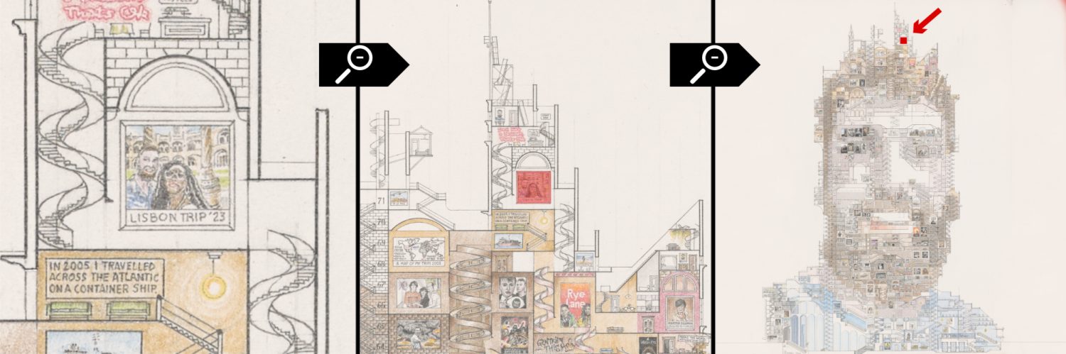
Here is a drawing of a 38 storey building (with two basement levels) which is in the shape of the Greater London Metropolitan Area. This map gives information about key events in London’s history which span for nearly 1000 years beginning with the construction of the Tower of London in around 1080 A.D. One starts in the centre of the map at this building, then follows a rough spiral where key buildings are positioned in their rough geographic locations, for example Westminster Abbey and then the Monument to the Great Fire. A miniature version of the famous before and after drawing by Wenceslaus Hollar is included in this history maze.
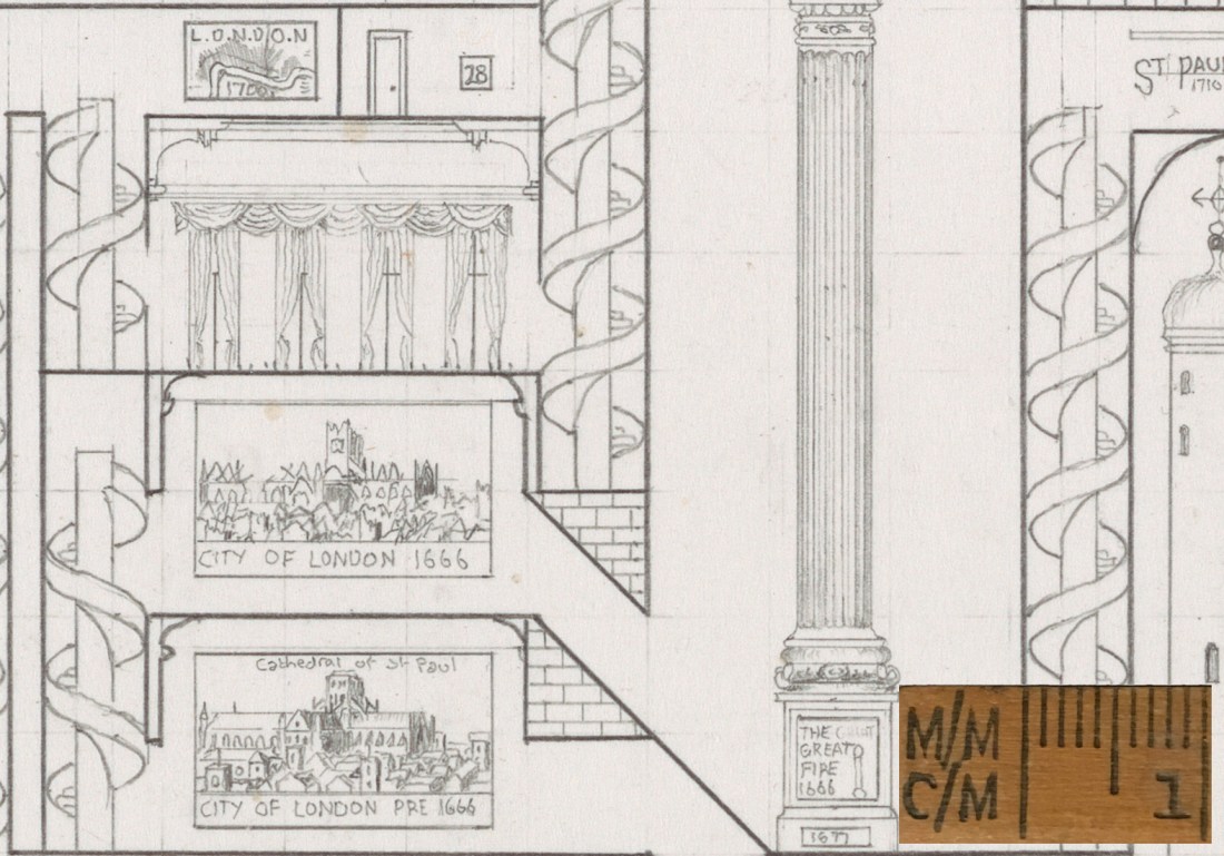
Before and After the Great Fire and the base of the Monument to the Great Fire
Big Ben and Benjamin Franklin’s house sit in their respective locations, beside the London Eye and an image of the Tate Modern. However despite these landmarks being depicted on the map as being close together, the chronological order of the maze path remains true.
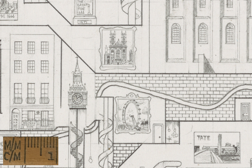
Westminster Abbey is feature to the top of this close up.
Iconic images of the Second World War also feature in this drawing, and a room with the famous ‘St Pauls Survives’ photo by Herbert Mason is featured in the basement, which would be in the extreme south tip of South East London. I included this there to reference the damage that this area of London received during the war due to its geographic location.
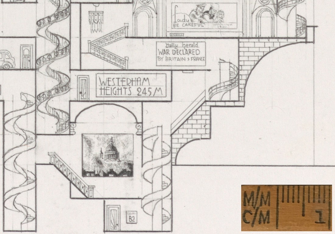
St Pauls Survives.
To conclude this brief overview, the drawing, or the structure is exited via Heathrow Airport, along a passageway where a portrait of the London Mayor hangs. In the room above the Boeing 747 jet are two famous images by the painter J.M.W Turner, ‘The Burning of the Houses of Parliament’ and ‘The Fighting Temeraire’ hanging in a small art gallery, again reached via the chronologically arrange labyrinth passages.
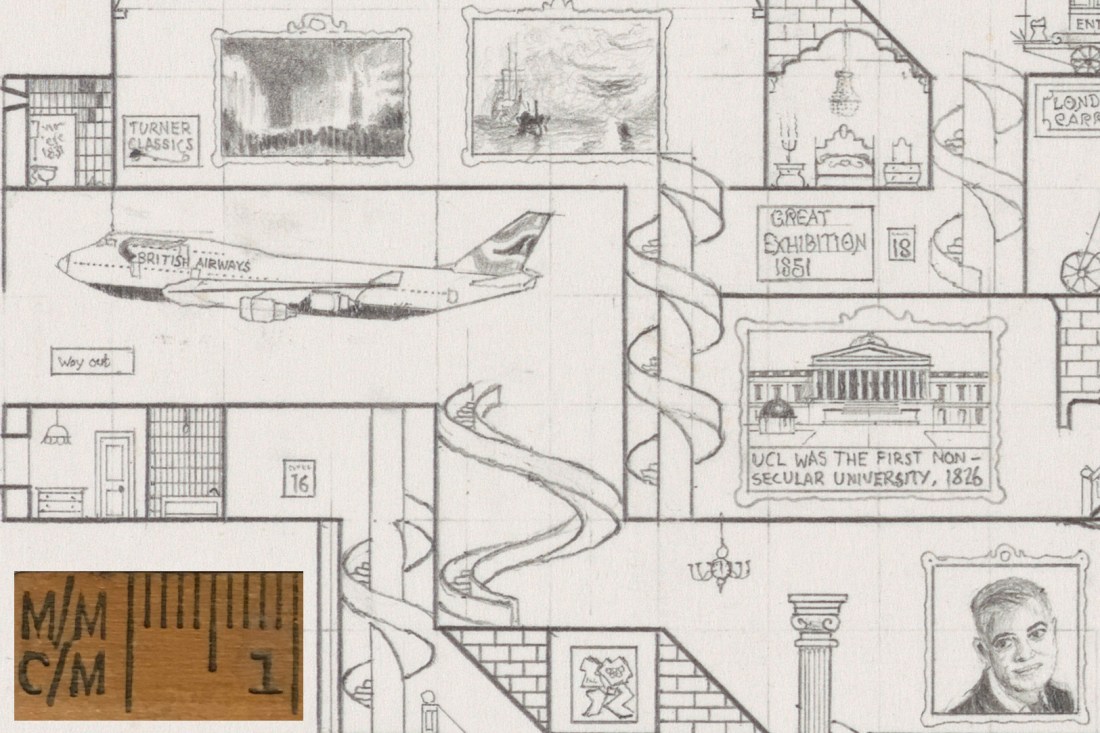
Goodbye, you are now leaving London via Heathrow.
